Dangerously hot conditions today, but it won’t last forever. There is hope for a break – albeit temporary.
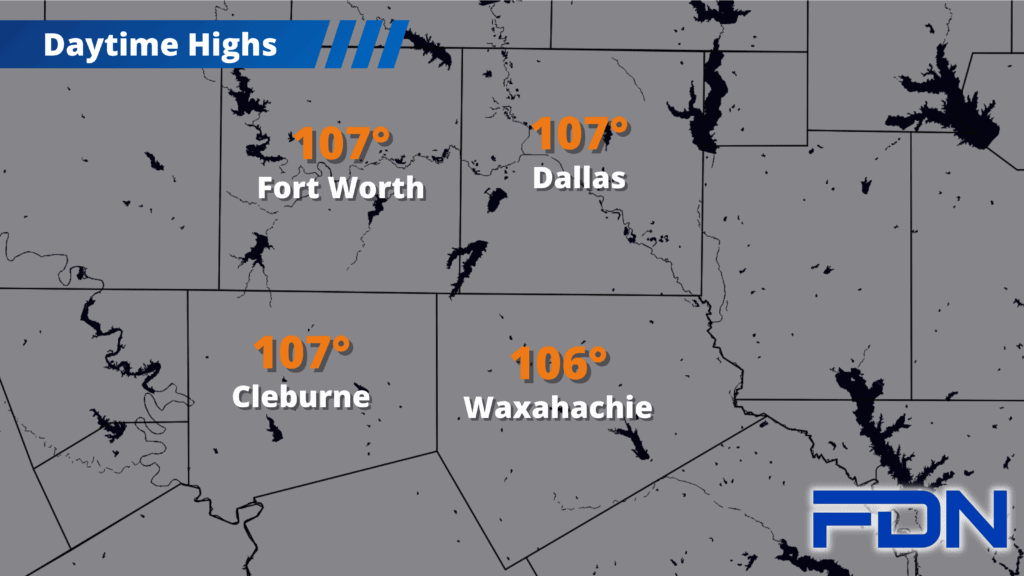
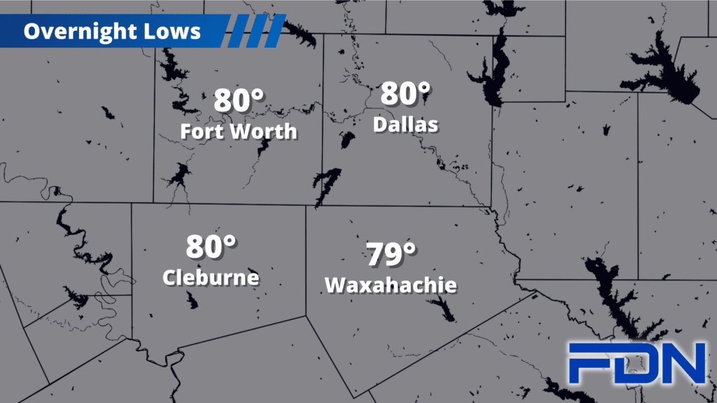
Air temperatures – not the heat index – will be in the 106°- 108° range today. The National Weather Service has Excessive Heat Warnings in effect that include Dallas, Ellis, Johnson and Tarrant Counties. The good news is that dew points look to be less intense, in the mid 50’s to low 60’s rather than the upper 60’s to around 70°. That will decrease the heat index (not that we need it to be stupid hot today). Increased wind and lower humidity, however, starts to shift concerns toward some fire issues; vegetation is still relatively green for the most part but there can still be plenty of dangerous fires that can spread quickly, and we don’t have any rain coming for the next few days.
Tomorrow and Thursday we’ll see hot temperatures continue to reach the low-mid 100’s, and then Friday we should top out in the low 100’s before a cold front arrives in our area. As timing of that front’s arrival refines, Friday’s high could increase if there is a later ETA. Either way, Friday will still be hot!
Cooler Weather…
Saturday and Sunday we will be cooler in the mid-upper 90’s, with a chance of showers/storms each day. Neither day brings a high chance of rain – just a few isolated storms are expected. I’m not expecting severe weather, but I’ll be able to speak to that more clearly in the next few days. Monday it looks like we’ll be back to the upper 90’s to around 100°, with triple digits likely returning next week.