


Is your phone going off with Code Red weather warnings? All of the Facebook weather pages are warning Texans to make preparations for hazardous conditions as a result of falling temperatures and precipitation.
Of course as we all know weather is unpredictable, but we encourage all readers to be ready for falling temps, dangerous roads, and potential power outages. Here’s the latest warning:
HISTORIC WINTER STORM POISED TO IMPACT THE REGION SUNDAY AND MONDAY…
Impacts will begin as early as Saturday morning with patchy freezing drizzle developing late tonight into Saturday morning, which will lead to a light glaze of ice in some locations. After a brief break in precipitation on Saturday, conditions will begin to deteriorate late Saturday evening, with precipitation transitioning from a sleet and freezing rain mix to all snow by Sunday.
The heaviest snow can be expected on Sunday and Monday. High winds will lead to blowing and drifting snow with wind chills falling to below zero by late Sunday. Snow will come to an end during the day Monday, but extremely cold temperatures will persist through mid-week. The heavy snow and forecast long duration of extremely cold temperatures will likely lead to major stress on the region’s infrastructure as well as crippling travel for several days.
* WHAT…Heavy mixed precipitation expected. Total snow accumulations of 3 to 6 inches and ice accumulations of a light glaze. Strong winds will lead to blowing and drifting snow reducing visibility to less than one mile at times. Wind chill factors below zero are forecast on Sunday, continuing into Monday and Tuesday.
* WHERE...Much of North and Central Texas.
* WHEN…From 6 AM Saturday to 6 PM CST Monday.
* IMPACTS…Travel will be dangerous. Hazardous conditions will persist for several days given the expected prolonged duration of extremely cold temperatures. The cold wind chills as low as 15 below zero could result in hypothermia if precautions are not taken.
* AFFECTED AREAS: FALLS … TARRANT … DELTA … GRAYSON … JOHNSON … CORYELL … HENDERSON … LEON … JACK … RAINS … HILL … LAMAR … MILAM … ERATH … MCLENNAN … STEPHENS … FREESTONE … DENTON … HUNT … SOMERVELL … MILLS … ROCKWALL … COOKE … FANNIN … EASTLAND … HOPKINS … PARKER … YOUNG … VAN ZANDT … BOSQUE … WISE … NAVARRO … ELLIS … LAMPASAS … DALLAS … LIMESTONE … COMANCHE … COLLIN … ANDERSON … MONTAGUE … BELL … PALO PINTO … KAUFMAN … HAMILTON … HOOD … ROBERTSON
Instructions:
Travel is highly discouraged on Sunday and Monday. If you must travel, keep tools necessary for survival in extreme cold in your vehicle. The latest road conditions for Texas can be found at drivetexas.org.
Winter Preparations:
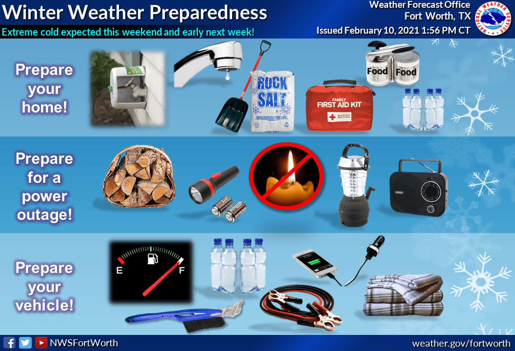
National Weather Service is urging residents to prepare today by making sure your flashlights have batteries, keep your devices charged, get firewood or propane, locate your weather radio, gather extra blankets, etc. Cover exposed outdoor faucets, leave inside faucets with a slow stream and keep house at a consistent temperature, open cabinets in kitchen and bathroom to expose plumbing. AAA Insurance reports the average frozen pipe claim costs more than $7,400, though the amount can be much higher depending on damage to personal property.
Know where your water shutoff valve is so that you can turn off the water in case of an emergency.


