We have one more day of cooler weather before Summer returns with a vengeance, but make no mistake – the road to Fall has begun!
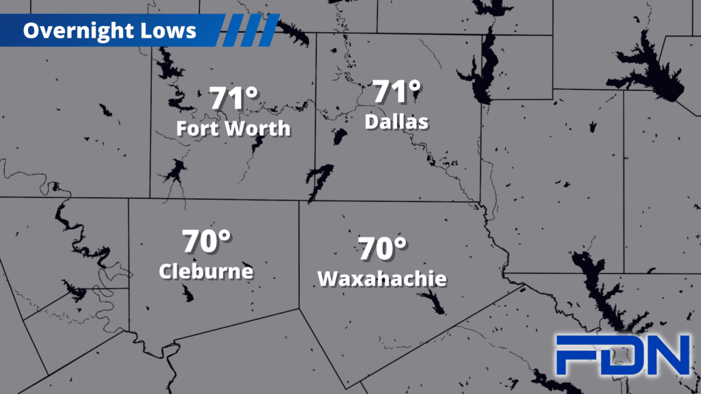
Temps are starting out in the upper 60’s and low 70’s, and will warm up to the mid 90’s again this afternoon. We have one more cool morning tomorrow, then things just get crazy.
Thursday and Friday the dry air will continue, which will allow us to heat up very efficiently as high pressure returns. Temperatures will top out around 107° for some of the hottest temps we’ve seen this season. This weekend the excessive heat continues, though perhaps a degree or two cooler.
Monday and Tuesday the high pressure system starts to build north early next week and the high temps subside a bit. We could see rain chances return midweek next week as easterly winds set in, but time will tell there. For now it looks like Summer will fight like hell to hang on…but it’s only a matter of time.
I also must mention that there is a potential tropical system brewing in the western Gulf of Mexico. There is a 20% chance of development in the next week, and I’ll continue monitoring it to see what it does. We’re approaching the peak of Hurricane Season, and the Atlantic looks to be coming alive right on schedule. Here’s hoping a little tropical action will bring us some rain!