It looks like any chance of real relief has left this week’s forecast, so now we look to next week for a shot at a cold front.
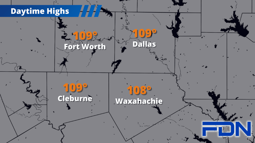
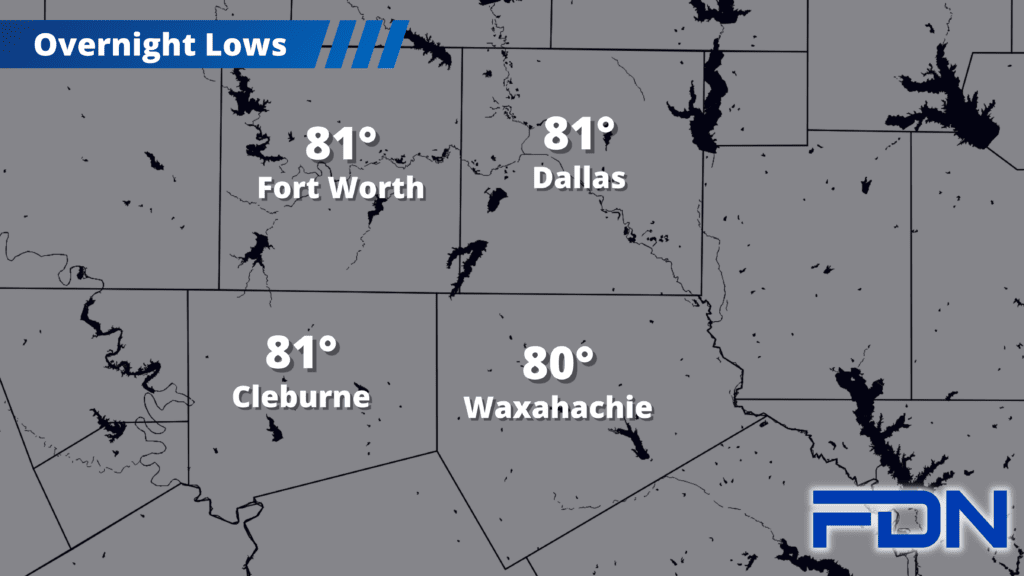
Temps will be in the upper 100’s today and mid-upper 100’s tomorrow, so make sure you stay safe and limit your outdoor activities during peak heating. Excessive Heat Warnings continue for at least today and tomorrow.
Tuesday and Wednesday look a little cooler with highs in the low-mid 100’s, but humidity will be higher so that will make things feel more uncomfortable even if we are cooler.
Thursday, Friday and Saturday we’re right back to the mid-upper 100’s for highs with a few clouds possible going into the weekend.
The tropical system we’ve been watching for in the gulf has a decent chance of developing – but will stay too far south to bring us any rain. Needless to say, dangerous fire risk continues across our area.
Our next chance for a pattern change – even a small one – comes early next week with a cold front that could bring us back to “normal” temps in the 90’s for the end of August/start of September. I’m not putting a lot of stock into this, as we’ve had that football pulled from us many a time this Summer (thank you to all who get that reference). I’ll continue to monitor it this week and update the forecast appropriately. Until then, it’s more of the same.
Good grief.