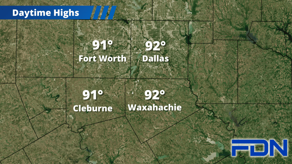
We have just a couple of days in the 90’s left before a strong cold front brings a big pattern change to cooler weather and a round of rain.
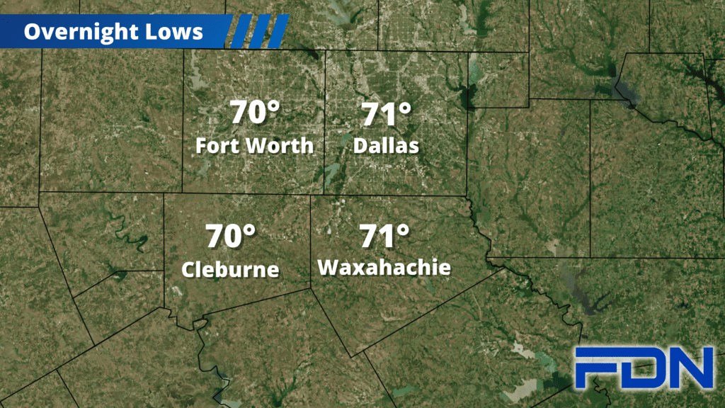
Today we’ll reach the 91°-92° range with breezy southeast winds, and tonight we cool to around 70°. Tomorrow we should be a degree or two cooler, with overnight lows around the same mark. We have a low chance of a storm or two tomorrow evening, but that will only happen if storms to our west manage to make it this far east (which is possible…but not likely). Winds will be breezy again tomorrow.
Wednesday we’ll have scattered showers/thunderstorms as a disturbance passes through ahead of the front, but a much higher chance of storms arrives Wednesday night/Thursday morning as the front moves through. While there is a low chance a marginally severe storm or two is possible, the higher risk will be flooding as heavy rain moves through and could come from slow-moving storms. Flood-prone areas should take necessary precautions.
We should dry out Thursday afternoon as the cool, dry air filters in, and we should only reach the low 80’s with some staying in the 70’s. Friday we’ll be cooler in the upper 70’s, and Saturday looks to be our coolest day in the mid 70’s. Sunday we warm up a bit into the upper 70’s as south winds return.