Excessive heat warnings will linger for a couple more days at least before a cold front moves in and finally takes the edge off.
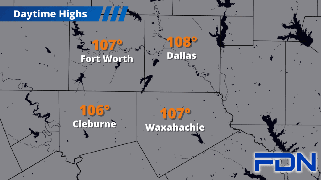
We’re in the 106°-108° range today and 105°-107° tomorrow with Excessive Heat Warnings continuing. An isolated shower/thunderstorm or two is possible today and tomorrow during the afternoon hours, but definitely not widespread rain.
Sunday the front moves in (earlier than originally expected), and we’ll still get warm Sunday before the front moves in – but not as warm as today and tomorrow. A few showers/thunderstorms will be possible again as the front moves through, though no severe weather is expected. A few more showers/storms will be possible Monday. Again, neither event looks like a washout – but I think a few of us will get at least some rain.
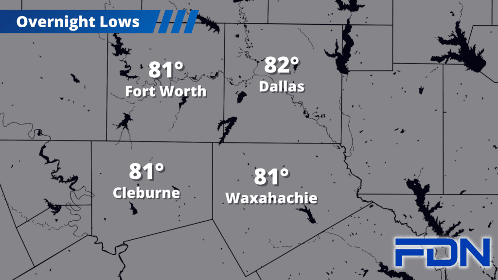
From Monday through Wednesday we’ll be in the mid-90’s with north/northeast winds. It will be cooler, but the dangerous fire risk will continue – so we can’t let our guard down. Overnight lows will be in the 70’s.
Thursday we start warming up again with easterly winds as we end August. I’m staying optimistic that we will stay just below the triple digits, though that could change to a warmer forecast as we get closer. The good news is it looks like trends keep us closer to 100°-101° than 105°-106° going forward. So, September may have some pretty warm days – but I think we’re finally getting into a less oppressive pattern. Stay tuned!