Our next storm system arrives overnight tonight, and temps remain cool for the 7-day forecast.
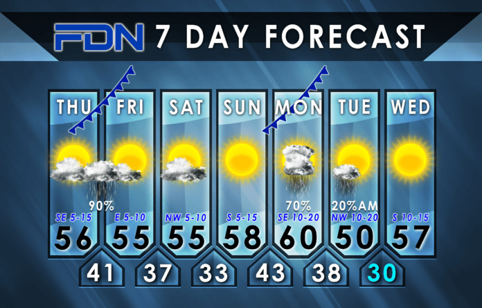
We’re starting the day with a Dense Fog Advisory that remains in effect through 10:00 am this morning. We’ll be dry through the day, but will remain mostly cloudy as our next rain maker approaches from the west. The rain moves in tonight, probably around 10 pm-midnight. I will continue overnight but should end for most of us before sunrise (maybe later east of I-35).
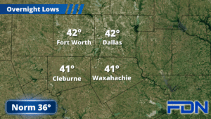
We’ll dry out tomorrow and stay in the mid 50’s for highs and upper tomorrow and Saturday, with overnight lows in the upper 30’s. Sunday we start warming up with highs in the upper 50’s, and overnight lows in the low 40’s.
The next storm system in line arrives Monday with gusty southeast winds and highs around 60°. This one could bring some thunder, but the severe weather should be limited to our south. Rain will likely last most of the day, and could persist into Tuesday morning. Tuesday will be blustery with highs topping out around 50° and gusty northwest winds. We drop to around 30° (some in the upper 20’s) overnight, then warm up to the mid-upper 50’s Wednesday with breezy south winds.
Still no arctic air in the forecast for our area. I’m watching models that continue to go back-and-forth on a storm system expected late next week, so still can’t nail down a forecast there. We have to give more time for consensus. For now, I’ll continue monitoring and bring any breakthroughs to you when I can!


