One of the hottest Summers on record rolls on, and August is fighting hard against any relief we might get.
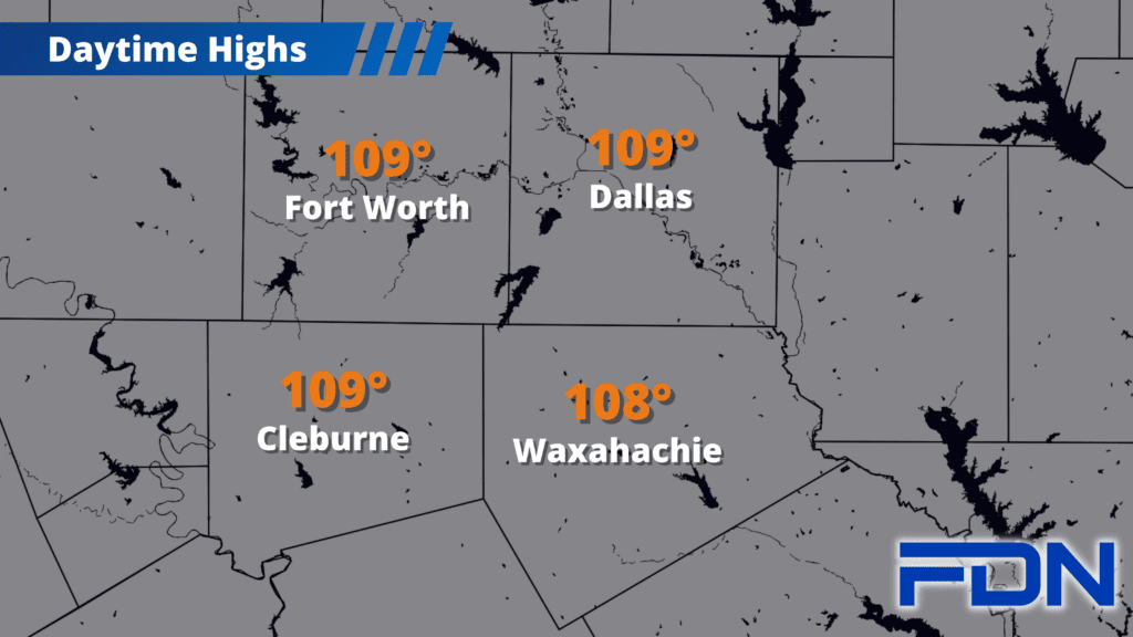
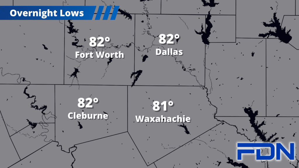
Today and through the weekend we’re in the 107-109° range in temperatures with Excessive Heat Warnings in place. Winds will be lighter, but as dry as we are, the dangerous fire risk conditions continue all through the forecast period.
Monday we are at 105°-106°, so we should be under an Excessive Heat Warning again. Tuesday we should see winds shift to the east as high pressure shifts northward, but we’ll still be in the low-mid 100’s. Wednesday looks to be our coolest day – but with the tropical low from the gulf now expected to track south of us, forecasted temps are creeping back up into the triple digits. That track may change…so I’ll keep watching. Thursday we just start climbing again with highs in the low-mid 100’s.
‘Normal’ temps are on the decline over the next couple of weeks as we head into Meteorological Fall on September 1, but August is stubbornly hanging on. The cavalry – coming in the form of El Niño in this case – will arrive eventually, but is going to make is be patient. Stay Safe and Carry On!