We’re getting into the warmest few weeks of Summer, and it’s going to pretty much fit every expectation of the season this week.
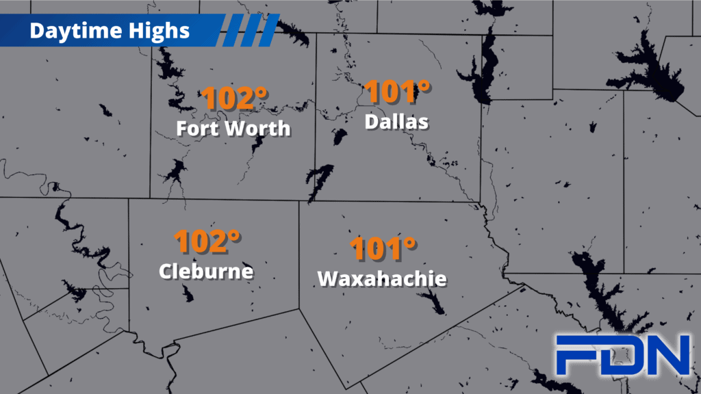
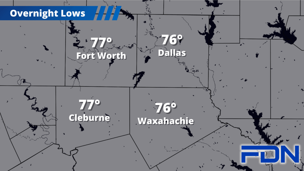
Today we return to the triple digits area-wide. Low wind could mean more pollution in the air, so keep that in mind if you are sensitive to it. The good news is that the humidity won’t be as intense as in weeks past, and that should be the case all week as the center of the high pressure dome stays west of us. Today and tomorrow we should mostly stay in the low 100’s. A Heat Advisory including Dallas, Ellis, Johnson and Tarrant Counties is in effect until 8:00 pm tomorrow night.
Wednesday and Thursday we’ll peak in our temperatures as we get closer to the mid 100’s, but we should also see some Saharan dust moving in that will make for a bit of haze in the sky – and probably some nice sunsets. Winds will increase, which will reduce the pollution hanging in the air…but will increase the risk of grass fires quickly spreading. Lower humidity will contribute to this concern as well, so be careful. Burn bans in Johnson and Navarro County continue, with Ellis and Hill counties likely to follow suit.
Temps look to slide a little lower as we get into the weekend, though we’ll still be in the triple digits. As I’ve mentioned recently, we’re getting into the few weeks where we are at peak Summer conditions – from mid-July to mid-August. Stay hydrated and shaded, limit outdoor activity during peak heating, follow burn ban restrictions or, when one isn’t active, use extreme caution with outdoor burning, and DO NOT LEAVE PETS OR CHILDREN IN HOT VEHICLES! I’m still baffled that the last one still has to be stressed. Stay safe!