A wet, warm week has begun and will bring much needed rain…but that rumored cold front is loaded up to make next week much cooler.
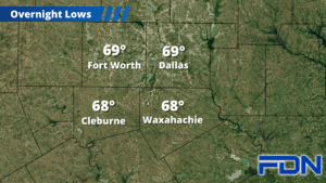
Today rain will increase in coverage through the day under cloudy skies as remnants of Hurricane Norma pass through. It will be mostly rain, though we could get a clap of thunder or two. Highs will be in the low 80’s, with lows tonight in the upper 60’s. Tomorrow stays cloudy and warm, but with lower rain chances. It will also be fairly windy, and tomorrow night remains in the upper 60’s.
Our best chance for rain arrives Wednesday with a strong disturbance, with the highest coverage Wednesday night into Thursday morning. A few claps of thunder will be possible, but severe weather isn’t expected. Friday and Saturday we should see lower rain chances and some sun, but highs remain in the low 80’s.
Let’s talk about Sunday. I’ve been hinting about a strong cold front that models had moving in toward the end of the month. One model has the front arriving sometime Sunday, another has it arriving early Monday. If it arrives Sunday, we’ll have falling temps through the day. Either way, it remains consistent in those long-range models that the front is headed our way and will bring a pretty steep drop in temperatures. It does look like dressing warm for Halloween will be a must.