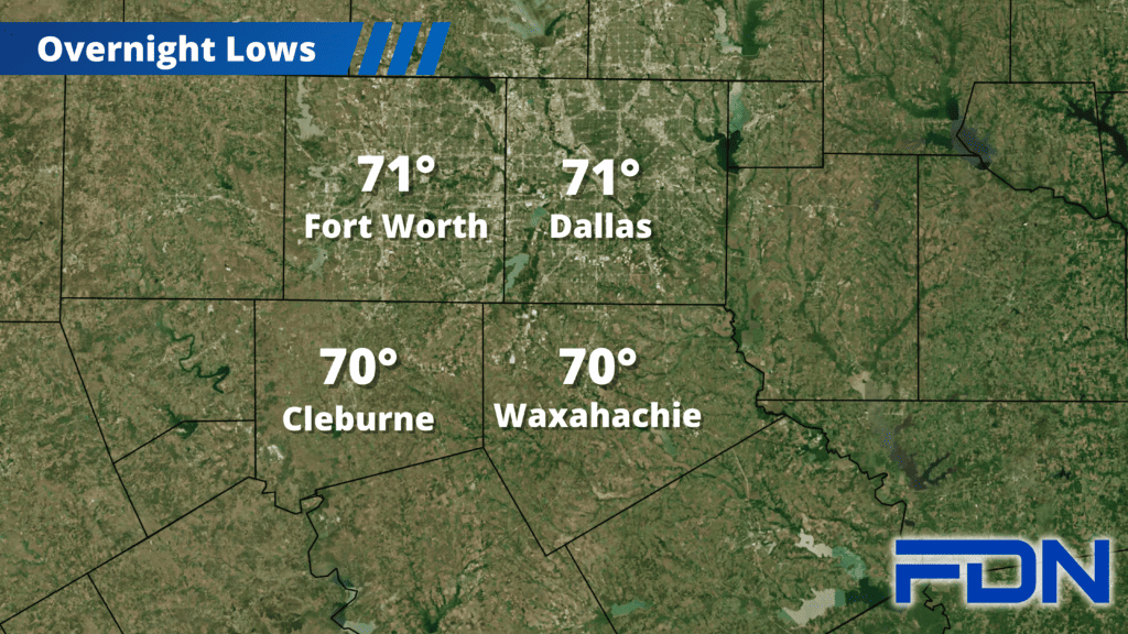
Active weather returns later today, and will lead to some of the coolest temperatures we’ve seen in quite a while. Here’s what to expect:
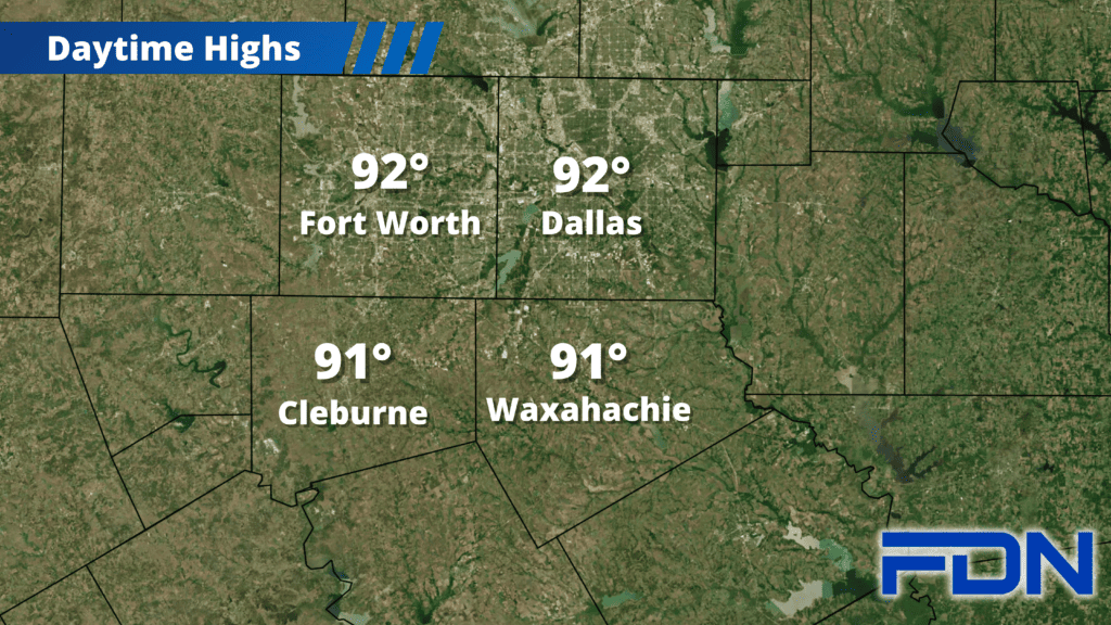
Today we will warm up to the low 90’s, and could see some showers/storms this afternoon and evening. We’ll see storms blossom to our west, but it looks more likely those will stay west/northwest of us. We also will see storms to our south that will try to make their way north, and some of these could reach us – especially south of Cleburne and Waxahachie. I don’t expect severe weather from these storms, though some could produce frequent lightning and gusty winds.
Tomorrow we’ll see more storms in our area, and could see them in waves. First we’ll see scattered storms in our area in the morning, then another round in the afternoon/evening hours. This afternoon round could bring a few strong/severe storms with large hail and strong winds, though I don’t think it will be a widespread severe weather event. There could be a lull in the activity between this afternoon round and the more widespread coverage of storms overnight along the front, but I’m not confident enough to expect it. That overnight round of storms that moves in late Wednesday night/early Thursday morning will come with the cold front. It’s looking like this could actually be closer to rush hour Thursday morning, but we’ll be able to refine that timing better over the next 24 hours. Either way, we’ll see a widespread coverage of heavy rain that should get everyone wet. This should exit by midday Thursday, and that afternoon we should only reach around 80°.
We’ll hit the same mark Friday afternoon, but then a reinforcing push of cool air arrives and brings us into the 70’s for the weekend and the start of next week. It looks like we’ll be back in the 80’s the rest of the work week next week.