The cooler air is here, and we’ll get a couple of days with much cooler weather before high pressure comes back and throws us right into another heat wave.
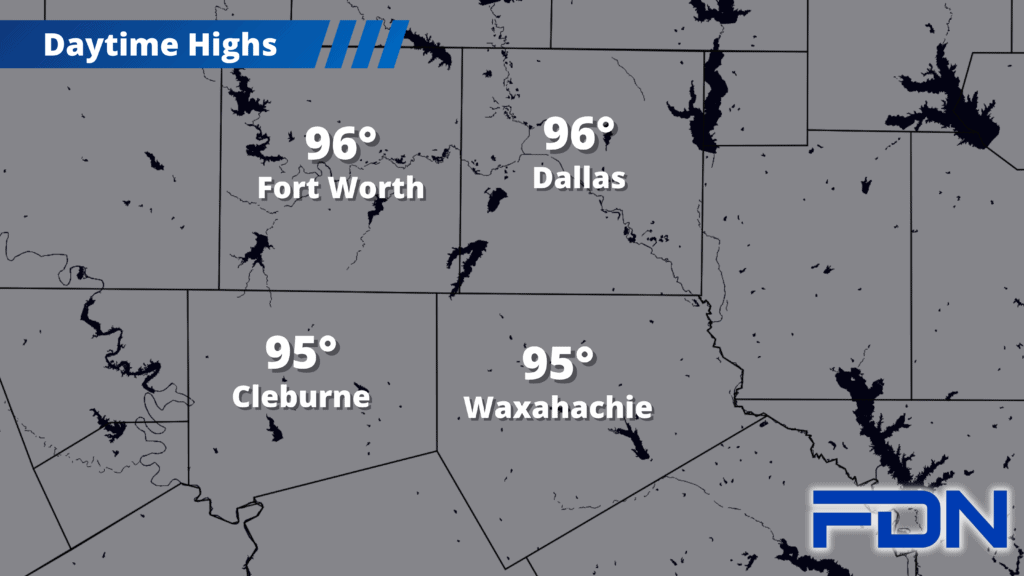
Today and tomorrow, we’ll top out in the mid-upper 90’s, with mornings in the low 70s and winds out of the north. Humidity will be low, so we won’t have much of a heat index in the afternoon hours. Navarro County got decent rain last night, but not enough to curb the fire danger – so we remain under dangerous fire conditions.
The remainder of the week shows us the downside of the dry air, which will heat very efficiently and rocket us back to the 106°-107° range as the high pressure ridge works its way back into place. Monday we cool down slightly, then another pattern shift – this one probably less potent temperature-wise – is possible next week as high pressure builds northward. This will bring easterly winds that could introduce rain chances.
I want to note that DFW’s normal temp drops to 96° today after having been at 97° since July 23, and Monday DFW’s normal drops again to 95°. We’re finally in the part of August where the normal temp starts slipping. Yes, high pressure is going to return and hold temperatures stubbornly above normal – but yesterday’s cold front and today’s normal temp shift are the first steps on the road to Fall!