We missed out on a break yesterday, and that was probably our last shot for a while.
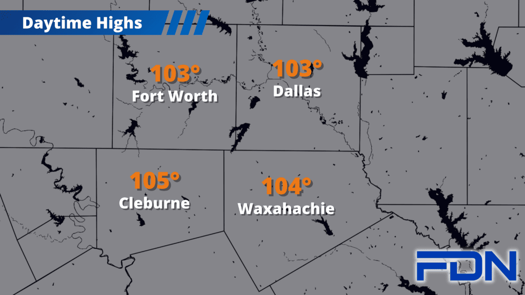
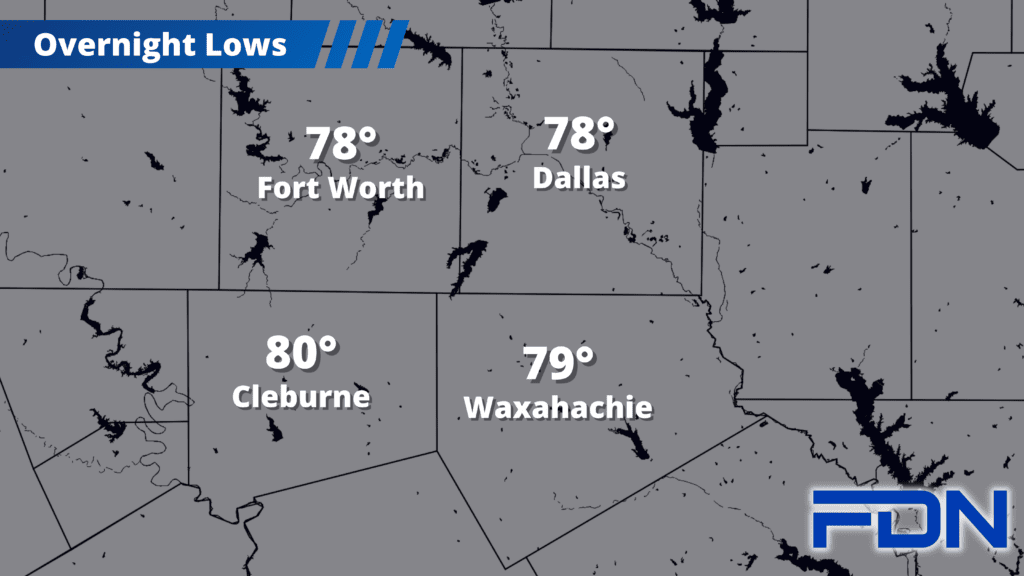
This morning it looks like there is an outflow boundary moving southward that has sparked some showers near Denton…I’m hopeful we’ll get a little something out of that. Just a 10% chance of a shower or two. After that, we get right back to the low-mid100’s for afternoon highs. The stationary front may make it south of Dallas and Fort Worth, making those cities a degree or two cooler. Red Flag Warnings and Excessive Heat Warnings are in effect today for Dallas, Ellis, Tarrant and Johnson Counties. Now, if we get VERY lucky…an outflow boundary could hang around our area and spark storms this afternoon. I think this is very unlikely…but not completely outside the realm of possibility.
We should see a few clouds over the next couple of days that will keep temps around 105°-106°, but later in the week we get to the 106°-107° point. Hot, hot, hot. There just is no stopping this powerful high pressure dome. A front is expected to move into North Texas Wednesday…but I’m not optimistic about it. Hopefully it impresses me…but I’m very skeptical.
The only hope for change I have is that – as I’ve been pointing to for a while – ‘normal’ temperatures start gradually declining next week, and it seems cold fronts are getting a little more successful in making it to North Texas. So, the SIGNS OF COOLER WEATHER are there…but I think it will be a slow decline as high pressure fights to hold its ground. Time will tell!